
West Virginia ZIP Code Directory Coverage by Prefix
ZIP Codes in West Virginia follow postal delivery routes, while most resident records are filed by county, district, municipality, or parcel. The research supports a statewide map of three-digit service-prefix groups and representative places, not an exhaustive five-digit directory. A West Virginia ZIP code directory can help choose the right regional search area, but every full address assignment should be checked with USPS before it is used to locate a parcel or interpret a local record.
The table below preserves the coverage described by the research. “Representative places” are not a list of every post office or ZIP, and the regional ranges do not identify every delivery point. Border valleys, rural roads, and small post offices make the accepted city name and county especially important for a West Virginia address.
| ZIP prefix | Representative West Virginia areas | Postal places | Coverage notes |
|---|---|---|---|
| 247–248 | Southern coalfield towns; Mercer and McDowell areas | Bluefield, Princeton, Welch | Virginia border; town and county names may diverge |
| 249–251 | Greenbrier, Monroe, Summers, Raleigh and nearby mountain communities | Lewisburg, White Sulphur Springs, Hinton | Rural routes may need E-911 or street-name searching |
| 252–253 | Charleston and Kanawha Valley; Logan, Boone and Putnam environs | Charleston and nearby postal places | Metro mailing places reach beyond some city lines |
| 254 | Berkeley and Jefferson counties, Eastern Panhandle | Martinsburg, Kearneysville, Charles Town, Shepherdstown | Verify the accepted city and post office for an address |
| 255–257 | Cabell, Putnam and Wayne areas | Huntington, Barboursville, Wayne | Mailing city and municipality can differ |
| 258–259 | Southern communities in Fayette, Raleigh and Summers areas | Beckley, Oak Hill and nearby small post offices | Rural delivery and street normalization matter |
| 260–263 | Northern Panhandle, Monongalia, Marion and surrounding counties | Wheeling, Moundsville, Wellsburg, Morgantown, Fairmont | Valley community and county seat may not match |
| 264–266 | North-central counties | Clarksburg, Weston, Grafton, Elkins, Buckhannon | Use county and district to distinguish similar place names |
| 267–268 | Eastern mountain counties | Keyser, Romney, Petersburg | Post-office name and county line may diverge |
USPS can assign PO-box-only ZIPs, unique ZIPs for a high-volume institution, and multiple city names connected to one postal delivery area. Those special cases are not fully represented by the West Virginia regional table. A Charleston mailing label may serve an address outside Charleston’s municipal boundary, just as a West Virginia neighborhood or rural address can carry a nearby post-office name.
Use the current postal lookup to confirm the five-digit assignment for a West Virginia address. Then keep that value separate from the county, city limits, magisterial district, and legal description. Those fields answer different West Virginia jurisdiction questions even when they appear together in an address card.
West Virginia ZIP Code Directory: Postal Cities
A ZIP identifies postal delivery geography. USPS explains its address, city-and-state, and cities-by-ZIP lookup modes; West Virginia postal assignments follow delivery routes and points rather than every incorporated place. That is why a postal city is not a dependable substitute for a municipal boundary, a county line, or the address that an emergency-services system uses.
The distinction is visible across West Virginia’s ridges, valleys, river corridors, and border communities. A road can cross incorporated and unincorporated areas while retaining a familiar mailing city. A post-office label may point to the nearest delivery center even when the parcel’s county or municipality is different. Charleston’s East End, West Side, Kanawha City, and Bridge Road planning areas also illustrate that West Virginia neighborhood boundaries and postal labels serve separate purposes.
A postal match is not a West Virginia people result. It can confirm delivery routing for an address or city, but it does not say who receives the mail, who owns the land, or who lives there. Use an official West Virginia parcel record for ownership and a separate record for any resident-specific question.
West Virginia ZIP Code and E-911 Address Fields
When a West Virginia postal address looks inconsistent, save the city name exactly as USPS returns it, then ask the local addressing authority about the place and street. Charleston routes address assignments and annexation questions through its planning and public-services channels; other West Virginia municipalities and counties use their own GIS, E-911, or planning offices. The Charleston process is one documented local example, not a statewide contact route.
The West Virginia Property Viewer’s address mode expects a West Virginia E-911 street address, city, and state. It does not resolve rural routes or post-office boxes in that mode, and the research notes that West Virginia address data can be incomplete. A ZIP printed beside an assessment address can help check a postal label, but the West Virginia county, parcel ID, and legal description still control the land record.
Verify West Virginia ZIP Codes at USPS
For West Virginia users, USPS offers three useful public lookup modes: by street address, by city and state, and by ZIP Code to see associated city names. The results provide an authoritative current postal assignment for the entered West Virginia address or place. A city search can return several postal areas, while a full address can resolve the specific delivery point. The service also cautions that a ZIP result does not confirm that a person or company is at the address.
| Find by Address | Enter a West Virginia street address with city and state, or street address with a known ZIP; use a unit number when needed. |
|---|---|
| Find by City & State | Enter a West Virginia city and state to see postal areas associated with that city. |
| Cities by ZIP | Enter a full ZIP to see accepted or recommended city names associated with it. |
| What the result means | Mail routing information only; it does not identify a resident or establish the property’s jurisdiction. |
The safest sequence is to verify the complete West Virginia address first, then carry the returned postal label into a county or parcel search. If a lookup gives multiple matches, add an apartment, suite, street direction, or other address detail. If the city name is unfamiliar, compare it with the current West Virginia county and local street record instead of replacing it with the municipality you expect.
The USPS ZIP lookup page shows its separate address, city-and-state, and cities-by-ZIP paths used for West Virginia verification.
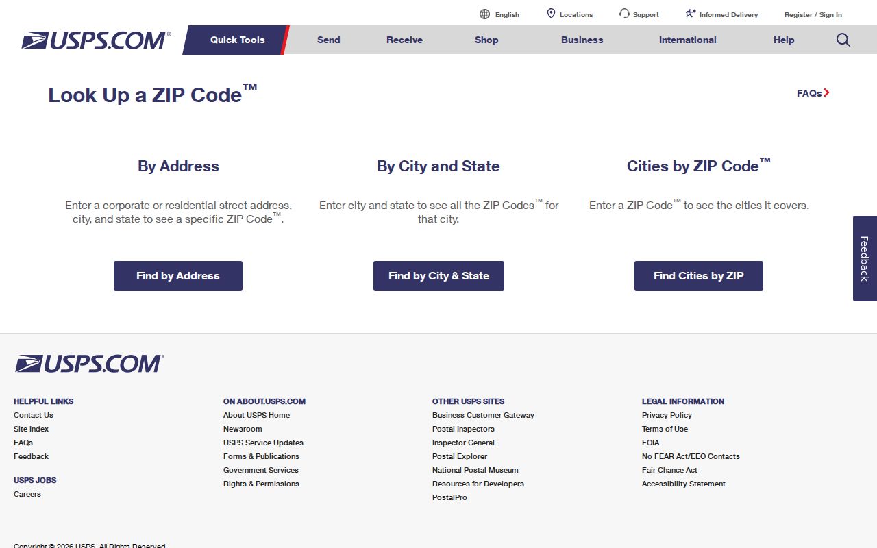
Use the matching lookup mode for the information already known, and save the accepted West Virginia city name with the result before searching public records.
Search West Virginia Parcels After ZIP Check
West Virginia property tools do not provide a complete ZIP-wide resident roster. The West Virginia state assessment search can narrow searches by county, district, owner, street name, parcel identifiers, property class, tax class, and land-use field. Address rows display a ZIP when present, but the West Virginia search is built around property and county fields. The West Virginia Property Viewer uses a West Virginia E-911 address, city, and state for its address mode; it is not a direct postal-code filter and excludes rural routes and post-office boxes.
| Assessment field | What to enter | How it helps | Limit |
|---|---|---|---|
| County | Select the county tied to the parcel | Narrows owner, parcel, and street searches | Postal city may be in another municipality or county |
| District | Choose the relevant county or corporate district | Separates similar street and place names | District labels vary by county |
| Street Name | Use the normalized street name | Finds a street within the selected county | Physical-address data can be incomplete |
| Owner or Parcel ID | Use a partial owner name or known parcel number | Connects the address to the assessed parcel | Owner is not necessarily an occupant |
| Property address | Try a shorter or normalized street form | Can surface an address record for map review | Do not treat a missing ZIP as proof of no parcel |
- Use USPS to confirm the full address, city name, and current postal assignment.
- Identify the West Virginia county and, when useful, the district where the parcel lies. Enter those fields in the state assessment search with a street or owner clue.
- Open the parcel in the West Virginia Property Viewer and compare the E-911 point, parcel boundary, and property details. Use street-name or parcel search if the address mode fails.
- Read the assessment result as an ownership and valuation record. Do not infer residence from the owner name or ZIP printed beside the property address.
- If the goal is a person rather than a parcel, use a separate record source and compare county, date, and name details. The West Virginia street directory guide explains the address-level path.
The West Virginia assessment results page caps a broad desktop search at 1,000 rows and offers CSV export. Refine the county, owner, or street query before exporting; a large result cap does not mean every record is complete or a ZIP filter is available. The free West Virginia Secretary of State voter-status lookup also has no ZIP field. Purchased West Virginia voter lists can be requested by county, municipality, district, or precinct, but not as a guaranteed ZIP extract, and their use is restricted by W. Va. Code §3-2-30(f). For a specific parcel, compare the map card and legal description with the West Virginia county assessor’s data.
West Virginia ZIP Code Areas and Census ZCTAs
The Census Bureau creates ZIP Code Tabulation Areas, or ZCTAs, to support statistical mapping in West Virginia and elsewhere. A ZCTA is a generalized area made from census blocks; it is not a USPS delivery route or an address-validation result. Blocks with addresses are assigned to one area based on the ZIP Code most often associated with those addresses. The Census Bureau notes that not every valid postal ZIP has a corresponding ZCTA.
This difference affects West Virginia comparisons. A Census table or map may use ZCTA geography, while a property record carries an address assigned by USPS. A dedicated institution or post-office-box ZIP may not map to a normal residential area. The ZCTA boundary follows census blocks and can be noncontiguous, while the mail assignment follows individual delivery points and routes.
Comparison: use USPS for a current West Virginia address assignment and Census ZCTAs for statistical geography, keeping the source type visible in any map or table.
- ZIP+4
- A four-digit extension tied to a more specific delivery segment or address detail after the five-digit ZIP; verify it for the individual address.
- PO-box ZIP
- A postal code assigned to a post office box group rather than ordinary street delivery. It may have no matching household geography.
- Unique ZIP
- A code assigned to one high-volume organization or institution, rather than a neighborhood-wide set of addresses.
- Carrier route
- A USPS delivery route grouping addresses for mail delivery. It is not a municipal boundary or a roster of residents.
ZIP Boundaries and West Virginia City Limits
A mailing city, county, municipality, magisterial district, E-911 address, and legal description are distinct fields in West Virginia. West Virginia postal city names follow delivery practice; the assessor follows county and parcel records; a town’s planning office uses its own incorporated and neighborhood boundaries. In a narrow valley or border community, a street’s postal label can be familiar while the parcel belongs to a different West Virginia local jurisdiction.
When two West Virginia sources disagree, save both values and ask each custodian the question it controls. USPS can confirm the postal city and current ZIP for a delivery address. The county assessor or Property Viewer can identify the parcel and county. A municipality or county addressing office can explain E-911 assignments, annexation, road naming, or address changes. For Charleston, the official call list routes addressing and annexation questions through a city contact; elsewhere, use the relevant local office.
A ZIP is an address clue, not a household record. It can help normalize a West Virginia mailing label before a search, but a parcel or resident conclusion needs evidence from the custodian that maintains the relevant record.
West Virginia ZIP Code History Needs Local Evidence
West Virginia ZIP assignments change over time. USPS Postmaster Finder can provide establishment or discontinuance context for a post office or ZIP, but historical directory pages may not capture every local split or realignment. The research review found no single official statewide ZIP-change chronology for West Virginia and did not retain a complete current five-digit extract, so the prefix table above is a guide rather than a dated ZIP inventory.
For an older West Virginia address, combine West Virginia post-office evidence with city or telephone directories, county plats and deeds, Sanborn maps where available, and local newspaper or municipal records. Preserve the street spelling and postal city used in the dated source, then compare them with a current West Virginia parcel and E-911 address. A gap in a modern lookup does not establish that a street or household did not exist.