
West Virginia Block Records for Neighbors
West Virginia has no single block-level resident roll. West Virginia parcel maps show nearby lots and owner details; assessment data adds parcel, class, and value fields; deeds and plats can clarify lot lines and transfers. A voter list is available through a separate request process, while planning pages and historical directories speak to a community or an earlier period. Each source has a different reach, so a block search should start with the parcel and make no claim about people the records do not name.
| Record source | Block detail it may show | How to reach it |
|---|---|---|
| West Virginia Property Viewer parcels | Adjacent parcels, physical addresses, owner/detail links, flood and tax layers | Free map with click, buffer, or geometry tools |
| West Virginia assessment search | Owner, parcel, class, value, and sometimes exemption fields | State search or county assessor directory |
| West Virginia deeds and plats | Recent transfers, lot/block, subdivision, and legal boundary clues | County Clerk portal or counter |
| West Virginia voter list | Registered names, residence addresses, and status in a purchased list | Secretary of State request form |
| Charleston, West Virginia planning and community pages | Named groups, district context, and public contact routes | Municipal page or public records request |
| West Virginia directories and Sanborn maps | Past street occupants or building form in specific years | Libraries, Archives, WVRHC, or digitized collection |
A map does not say who is home, and an assessed owner may receive mail elsewhere. Directories are dated, voter lists show registration rather than every resident, and neighborhood pages do not publish member rosters. These West Virginia sources can describe the block's parcels and public groups without turning the map into a household list.
Mapping West Virginia Neighbors by Parcel
Begin with one standardized E-911 address in the WV Property Viewer. Open its parcel, zoom until the borders appear, switch on address labels, then inspect the touching shapes or rows. The map also allows a rectangle, polygon, or buffer geometry search when lots overlap or the block is wide. A geometry result helps locate parcels, but it does not guarantee that a boundary is a legal adjacency.
- Record the start parcel's ID and physical address.
- Click the adjacent parcel shapes and note each parcel ID and owner field.
- Compare the situs address with the mailing address and any county exemption field.
- Use a buffer or drawn shape if the block has stacked or crowded parcels.
- Check the plat, deed, or assessor when an edge or shared lot line matters.
The viewer's search controls include these fields and modes:
| Search control | Type | Required | Notes |
|---|---|---|---|
| West Virginia Property Viewer E-911 address | Text | Optional | Use street address, city, and WV; rural routes and PO boxes do not match. |
| West Virginia Property Viewer parcel attributes | County selector and text fields | Optional | County, owner, property address, parcel number, or parcel ID parts. |
| West Virginia Property Viewer geometry search | Map drawing | Optional | Point, rectangle, or polygon with optional buffer size. |
| West Virginia Property Viewer coordinate search | Latitude and longitude | Optional | Enter both values. |
| West Virginia Property Viewer map controls | Buttons and layer toggles | After search | Export CSV, View in Map, identify, highlight, copy link, download KMZ, and layer switches. |
West Virginia desktop results are capped at 1,000, so narrow the search by county, district, or street before exporting. A full address-by-address chain belongs in the West Virginia street directory walkthrough; the block view stays focused on nearby parcels. The state parcel viewer displays outlines, address labels, and flood or reference layers for map context.
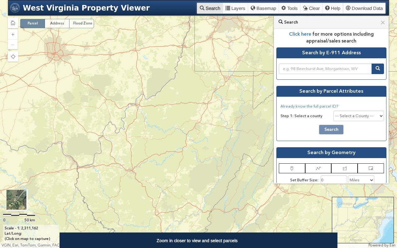
Layer color or a map edge is a lead for the next record check, not a substitute for a deed, plat, or survey.
Parcel Owner Records Around a Block
Owner and address fields can make adjacent parcels look more personal than they are. The property viewer may show one owner in a result row, while the detailed panel can differ. The physical or situs address locates the parcel. The mailing address shows where tax correspondence goes and may be in another place or in an entity's name.
Do not treat a mailing address as evidence of residence. A homestead or exemption indicator can be a useful clue when a county exposes one, but the statewide fields do not guarantee that it appears. If the assessment data look wrong, the county assessor is the correction route; if title or the lot edge is in question, check the County Clerk deed or plat and ask the assessor to verify the mapped parcel.
For each neighboring parcel, retain the parcel ID, physical address, owner name, mailing address, and source date as separate notes. This keeps an owner record from becoming a claim about a household.
The detailed result can show:
- West Virginia GIS or parcel ID, county, district, map, parcel, and suffix.
- West Virginia owner, physical address, and deeded acreage, with one owner possibly shown in the list.
- Delinquent status, community, flood information, external map links, and description where populated.
- Building information, cost values, appraised values, and separate parcel or tax-district layers.
West Virginia Voter Records for Neighbors by Block
The free West Virginia voter status search uses first name, last name, and date of birth. It has no public address or street field. A precinct or county list can be requested from the Secretary of State, and it includes residence address, county, party, active status, and registration date. Optional fields include mailing address, birthdate, precinct, and legislative or congressional districts.
Partial lists cost $25 per hour; statewide products have set fees, and delivery follows payment and first-come-first-served processing. The request can be mailed, faxed, or emailed in spreadsheet, delimited-text, or PDF form. West Virginia purchasers certify the purpose, and W. Va. Code §3-2-30(f) bars commercial or charitable solicitation and advertising, as well as resale or reproducing the list for resale.
A voter list is a dated registration record, not a household map. It may not show a normal address for a participant in the Address Confidentiality Program, and it should not be used to infer everyone at a parcel.
The Secretary of State voter lookup is useful for a known person, while broader lists follow the separate voter data request process.
Charleston, West Virginia Neighbor Associations by Name
West Virginia has no authoritative statewide directory of neighborhood groups or membership lists. The Charleston Planning page offers a documented municipal example, listing four neighborhood associations and partner organizations. This Charleston, West Virginia example is a route to public community information, not a roster of who lives on a street.
Bridge Road Neighborhood Association
Listed by Charleston Planning as a neighborhood association. Use the city's planning page for public group information.
East End Community Association
Listed as a community association and planning area. Use the city's planning page for public group information.
Kanawha City Community Association
Named on the city planning page. No public member roll is listed there.
West Side Neighborhood Association
Named on the city planning page. No public member roll is listed there.
Charleston Area Alliance, Charleston Main Streets, and Charleston Urban Renewal Authority also appear as partner or community organizations. The city does not publish association member rolls on the cited page. Use public meeting notices or official contact channels rather than guessing who belongs to a group.
The city's neighborhood planning page shows the listed groups and partner organizations.
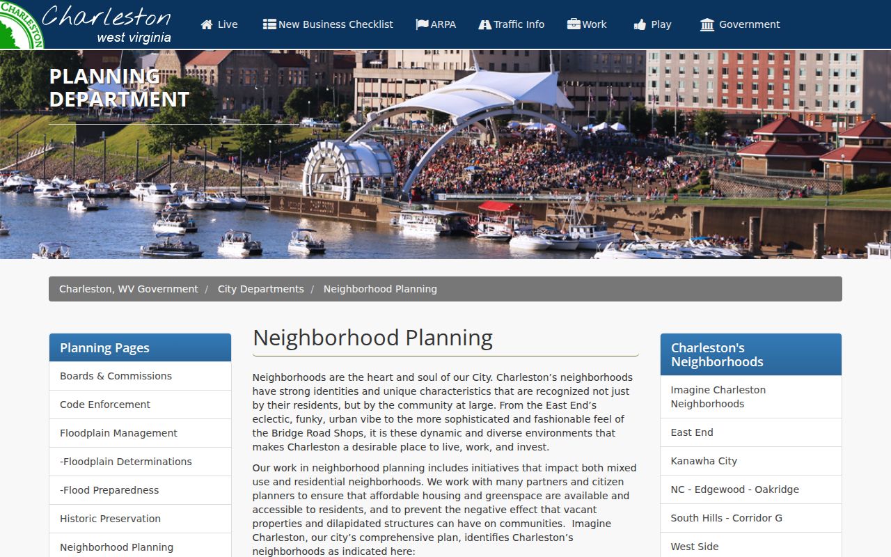
For other towns, start with the municipality or county planning office, then check civic, Main Street, or regional planning pages for a public contact route.
West Virginia Neighborhood Boundaries by Postal ZIP
Charleston's East End, West Side and Elk City, Kanawha City, and Bridge Road are named planning areas or partner neighborhoods. A neighborhood boundary, historic district, annexation line, municipality, and ZIP can each describe a different kind of place. The planning page notes that neighborhood context and ZIP geography are separate from a parcel's postal label.
That matters on a block near a city edge or along a river valley in West Virginia. A mailing city can reach outside the incorporated limit, while an E-911 address and county parcel record point to their own jurisdictions. Keep county, district, municipality, physical address, and ZIP in distinct fields instead of using one as a stand-in for the others.
In the northern panhandle, regional directories and telephone books may span communities in Pennsylvania or Ohio. A West Virginia neighbor search can therefore need the exchange or nearby place name as well as the current town label.
West Virginia Neighbor History in Sanborn Maps
Historic maps can help explain why adjacent parcels or house numbers no longer line up with current West Virginia street patterns. WVU's digitized Charleston Sanborn collection has 281 TIFF files and map years from 1884 through 1933. The sheets show building footprints, lot patterns, street continuity, and use, rather than a list of past residents.
Compare a Sanborn sheet with the current parcel map, a deed description, and a directory year before tying a name to a building. Remote or in-person access is available through the collection process. This is especially useful when a road name, street number, or municipal label changed over time.
Sanborn evidence describes the built block at a dated moment. It cannot identify who was inside a building on that date.
The WVU Charleston map collection lists the years and linked map records.
Official Records and Compiled Neighbor Tools
Official West Virginia parcel, deed, voter, and planning sources are maintained for distinct public tasks. Commercial people-finder services compile public records, directory data, and other sources into a combined result. The two routes differ in how close they stay to a source record and how a correction must be handled.
| Route | What it can answer | Limits to keep in mind |
|---|---|---|
| West Virginia official parcel and assessment records | Which lots and assessed owner fields surround an address | Not a complete or current resident list |
| West Virginia County Clerk deeds and plats | Recorded parties, transfers, and legal land descriptions | Coverage and image access vary by county |
| West Virginia voter request data | Registration fields in a requested county or precinct list | Separate request rules and use limits apply |
| Commercial services compiling West Virginia records | Combined records and directory references from multiple sources | Sources, update timing, and correction routes vary by service |
For an error in a parcel or deed record, contact the office that holds it. A commercial service's own opt-out or correction path is separate, and no universal statewide deletion process was located in the research.
Privacy Limits Around West Virginia Neighbors
West Virginia parcel and voter records do not expose every person connected to an address. Household members and visitors do not appear merely because a parcel has an owner; utility, delivery, and DMV address data are not public neighborhood lists. Courts and custodians can also restrict sealed, expunged, juvenile, adoption, mental-health, or protected-victim information.
West Virginia's Address Confidentiality Program gives eligible survivors of domestic violence, sexual assault, stalking, or human trafficking a substitute address through an approved application assistant. Participants can use it for covered mail and voter registration, and certification lasts four years. The Secretary of State's ACP information page explains eligibility and the application route.
Lawful use. Keep a West Virginia neighbor search to personal research, public parcel context, and community contact. Respect statutory redactions and substitute addresses, and do not use records to stalk, harass, or harm anyone.
A block map is most useful when it stays a map of public parcels and community context, not a claim about a private household.